Medicine Hat Landmark Driving Tour 2.0
We are excited to launch our Medicine Hat Driving Tour 2.0! We created the tour to allow you to enjoy iconic Medicine Hat spots while adhering to social distancing measures. Thanks to everyone for their great 2.0 suggestions! To see the original landmark list click here:Medicine Hat Driving Tour
We've included the GPS coordinates (or click for the Google map directions) and a brief audio description for each stop on the tour. Click the Learn More button has even more great details about these Medicine Hat landmarks. Please adhere to physical distancing measures while participating in our Driving Tour, we have created this so you don’t even have to get out of the vehicle!
Don't forget to share your pictures with us of your favourite spot! @staymedicinehat

Canadian Pacific Railroad StationThe Canadian Pacific Railway was the catalyst for the founding of the City of Medicine Hat. |

St. Patrick's Roman Catholic ChurchThis 108 year old National Historic Site of Canada was inspired by the medieval cathedrals in Europe and is known for being a triumph of engineering-science for its time. |
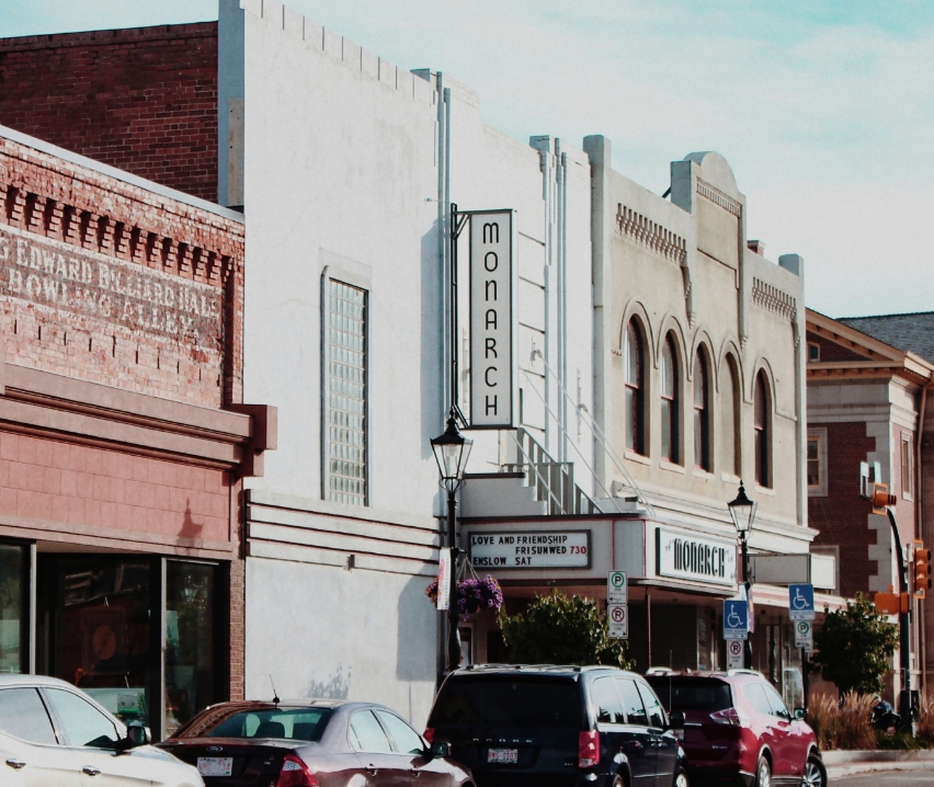
Monarch TheatreBuilt in 1911 as a motion picture theatre and amusement house, the Monarch was the first of its kind in Canada and is still in operation today! |
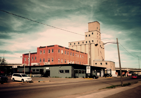
Five Roses Flour MillFive Roses Flour Mill, located on South Railway Street, which is now home to a local pub, is a major part of Medicine Hat history. |
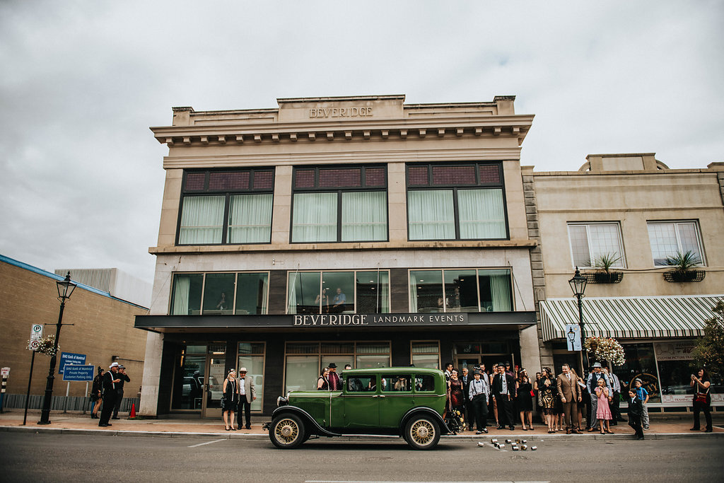
Beveridge BuildingThe Beveridge building is representative of a period of economic growth in the city prior to the First World War. It is characterized by its classic detailing, size and facade. |
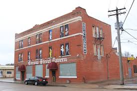
Corona HotelThe Corona Hotel built in 1912, was a half a block east of the CPR Station, which made it highly attractive to settlers arriving to the city. |